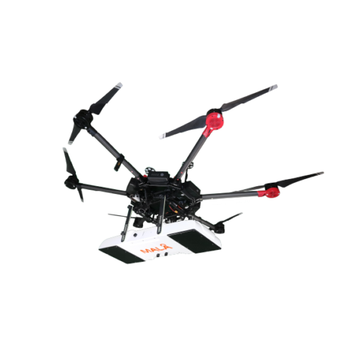
MALÅ GeoDrone antennas are advanced airborne GPR systems tailored for efficient data collection in remote, hazardous, or inaccessible environments such as snow-covered terrain, rocky ground, rivers, lakes, or avalanche zones. Powered by MALÅ’s proprietary HDR technology, they deliver unparalleled clarity and depth in even the most extreme conditions.
Key Features
-
Utilizes MALÅ HDR real-time GPR technology
-
Compatible with most drones with sufficient payload capacity
-
Optimized for fully automated drone-based surveying
-
Wireless real-time monitoring via MALÅ Controller App
-
Includes MALÅ Motion Trig for precision-triggered acquisition
-
Seamless data processing with MALÅ Vision (Web + Desktop)
Application Areas
GeoDrone 80 – For larger targets (>1 m) up to 10 m depth:
-
Deep subsurface layer detection
-
Bathymetry profiling (lakes/rivers)
-
Detection of sinkholes, cavities, bedrock depth
GeoDrone 600 – For smaller targets (<1 m) up to 4 m depth:
-
Shallow structure mapping
-
Profiling riverbeds and sediment layers
-
Snow/ice measurements and shallow void detection
Liability Note:
Users must verify all applicable laws and permissions (e.g., ETSI, FCC) regarding airborne GPR in their region. Guideline Geo assumes no legal responsibility.